


History
Six municipalities: Makino Town, Imazu Town, Kutsuki Village, Adogawa Town,Takashima Town, and Shin-asahi Town, grouped as “Takashima Gun” have merged together on the 1st of January 2005, and made a new start as “Takashima City.”
“Takashima Gun” was originally formed about 1,300 years ago following the nation wide place-name reform in 701 by which the current Shiga Prefecture was named “Omi.” At that time, the land readjustment was also performed and Japan’s original land division system was established
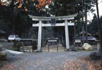
In Takashima City, there are several ruins that are supposed to be the local government office in that period.
Since ancient times, this area has flourished as an important traffic point. National Route 161 that runs along Lake Biwa was called “Hokurikudo” in the ancient time, “Nishi-omiji” or “Hokkoku-kaido” in the middle and the modern ages. It was fully utilized as a main artery that connects Hokuriku region, the central part of Honsyu facing the Sea of Japan,and Kyoto/Nara region where the capital used to be. National Route 367 that goes through the mountainous area of Kutsuki district is known as the shortest way from Hokuriku region to
Kyoto. National Route 303 running from Imazu district to the west has served as a highway connecting Wakasa Obama district in Fukui Prefecture and Lake Biwa. A part of National Route 161,a pass over the mountain from Makino district to the north, also served as a highway connecting Echizen-Tsuruga district in Fukui Prefecture and Lake Biwa.
As there are some navigable rivers such as the Ado River and the Isida River,timbers cut down in the western mountains were transported down the lake,then to Kyoto/Osaka area by boat.
For such a long time, “Takashima Gun” has played various roles in relation to the roads and the rivers. Finally, though, the time to put a period to the 1,300 years of its tradition had come on the 31st of December 2004, and “Takashima Gun” was taken over by the newly born Takashima City.

この記事に関するお問い合わせ先
〒520-1592
滋賀県高島市新旭町北畑565
電話:0740-25-8000
ファックス:0740-25-8101
秘書課へのお問い合わせ
更新日:2023年03月31日